

Spring · Summer · Fall
Hiking & Trails
Greenville sits where the Moosehead Lake shoreline meets the mountains, and some of Maine's best day hikes start within a half hour of King's Landing. There are ledge walks that look down on the whole lake, a fire-tower summit on a peninsula of 700-foot cliffs, a slate canyon carved by the West Branch of the Pleasant River, and a state-park shoreline path where loons are the only crowd. This guide covers the trails we send guests to most, with distances, trailheads, fees and what you will actually see, checked against the land managers' own pages.
Drive times are from downtown Greenville. Many trailheads sit on gravel logging roads where trucks have the right of way, so a full tank, a paper map and low expectations for cell coverage go a long way. The Little Moose trails are ten minutes from the house; Kineo's shuttle is half an hour; Gulf Hagas is a full day.
The trails at a glance
| Trail | Round trip | Climb | Effort | Drive | Fee |
|---|---|---|---|---|---|
| Little Moose ponds loop | 3.8 mi | modest | easy to moderate | 5–10 min | none |
| Big Moose Mountain | 4.2 mi | about 2,000 ft | moderate to hard | 10 min | none |
| Lily Bay shoreline | 2 to 2.4 mi | flat | easy | 15 min | $6 adult |
| Mount Kineo | 2.6 to 5.7 mi | about 820 ft | easy to moderate | 30 min + shuttle | $4 + $15 shuttle |
| Borestone Mountain | about 5 mi | about 1,250 ft | moderately strenuous | 40 min | $5 donation |
| Number Four Mountain | 4.2 mi | about 1,470 ft | moderate | 35–40 min | none |
| Little Wilson Falls | 2.4 to 2.6 mi | about 300 ft | easy | 40 min | none |
| Gulf Hagas rim loop | 8 to 8.6 mi | about 1,000 ft | moderate, rough footing | 60–90 min, gravel | $18 adult |
| Eagle Rock | 7.4 mi (or 1.3 mi steep) | 780 to 1,300 ft | moderate to hard | 25 min, rough road | none |
| White Cap Mountain | 6.6 mi | about 2,000 ft | strenuous | 60 min+, rough road | none |
Fees are 2026 non-resident adult rates; Maine residents, seniors and children pay less. Distances follow Maine Trail Finder and the land managers; other guides differ by a few tenths of a mile.
Big Moose Mountain
- Round trip
- 4.2 miles
- Climb
- about 1,850–2,100 ft
- Summit
- 3,150 ft
- Effort
- moderate to challenging
- Time
- 3–4 hours
- Drive
- about 10 minutes
- Fee
- none
- Dogs
- allowed
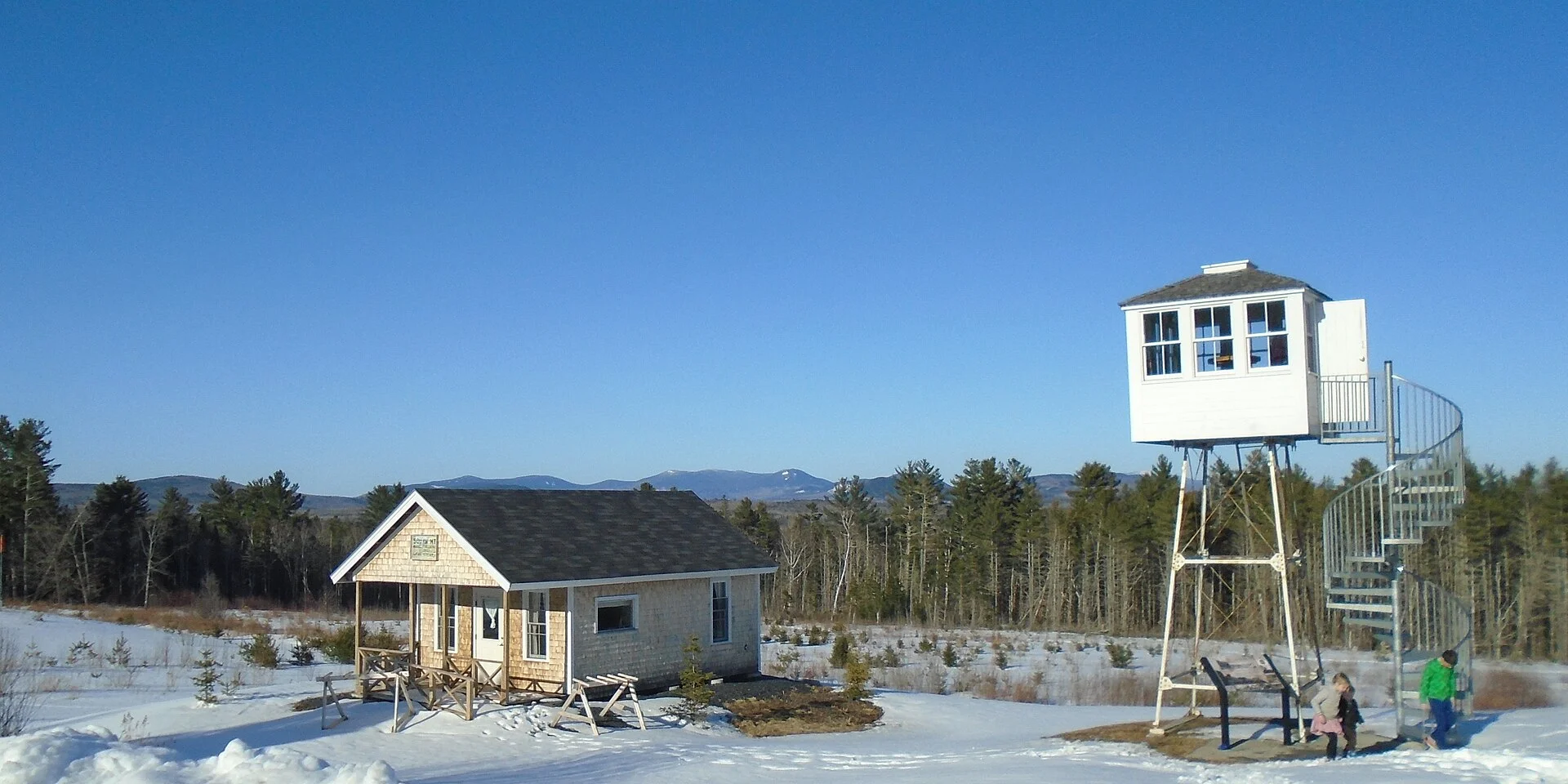
The big one, and the closest big one. Big Moose (still "Big Squaw" on older maps) rises straight out of the west shore, and its summit ledges look over Moosehead, Mount Kineo, the Spencer Mountains and, on a clear day, Katahdin and the Bigelows. The trail climbs in two stages: a steady 1.4 miles through hardwoods and along a brook to the old fire warden's cabin, then a much steeper 0.7 miles of stone steps and ledge to the top. This was the site of the nation's first fire lookout tower (1905); the steel tower itself was flown off the summit by helicopter in 2011 and now stands at the Natural Resource Education Center on Route 15 in Greenville, so expect four concrete footings and the communications buildings up top rather than a tower to climb.
Getting there: take Route 6/15 west from Greenville about 5 miles, turn left on North Road (gravel) and continue about 2 miles to the parking area on the right. There is no cell service on the trail. The ledges are slick when wet, and the upper section is not a good choice for small children or anyone unsure of their footing. Managed by the Maine Bureau of Parks and Lands as part of Little Moose Public Reserved Land.
Sources: Maine Trail Finder · Maine Natural Areas Program hike sheet (PDF) · Maine by Foot
Little Moose Mountain & the pond loop
- Pond loop
- 3.8 miles (network 9.7 mi)
- Ridge
- about 2,000 ft
- Effort
- easy to moderate
- Time
- 2–4 hours
- Drive
- 5–10 minutes
- Fee
- none
- Dogs
- allowed
- Camping
- 7 primitive sites
Our default recommendation for a first afternoon. Little Moose Public Reserved Land is more than 15,000 acres of state land just west of Greenville Junction, threaded by nearly ten miles of trail that link Big Moose Pond, Little Moose Pond and the Notch Ponds beneath a long ledgy ridge. The classic outing is the 3.8-mile loop around the two big ponds: open ledges with a sweeping view north to Big Moose Mountain, the lake and Kineo, then pond shores, small waterfalls and a good chance of moose sign. Seven first-come primitive campsites with outhouses sit half a mile to a mile and a half in, if anyone in the group wants a night under the stars without a long carry.
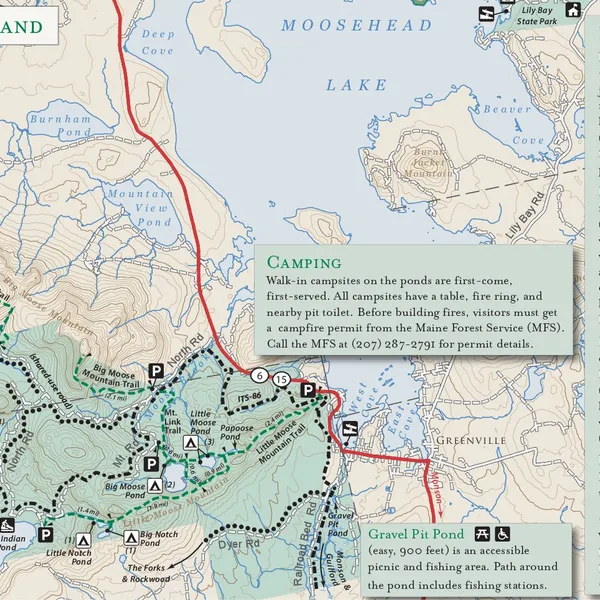
Trailheads: the easiest is on Route 6/15 beside the Moose Mountain Inn, about a mile north of the Greenville Junction railroad trestle (about 2.4 miles of trail to the loop). The Big and Little Moose Ponds trailhead on North Road puts you on the loop faster. Gravel Pit Pond, off the same road, has an accessible 900-foot path to a picnic and fishing spot. Snowmobiles and ATVs share parts of the unit in season, and the state asks visitors to respect mud-season closures in April and May. The trail map below is the Bureau's own.
Sources: Maine Trail Finder · Bureau of Parks and Lands: Little Moose · Natural Resources Council of Maine
Mount Kineo State Park
- Trails
- Indian 0.9 mi · Bridle 1.1 mi · North 1.9 mi · Carriage 2.2 mi
- Climb
- about 820 ft, dock to tower
- Summit
- 1,789 ft
- Effort
- easy to moderate
- Time
- 2–2.5 hours plus the boat
- Drive
- 30 minutes to Rockwood, 10-minute shuttle
- Fees
- $4 non-resident adult park fee; shuttle $15 round trip, cash
- Dogs
- allowed on a leash; ride free
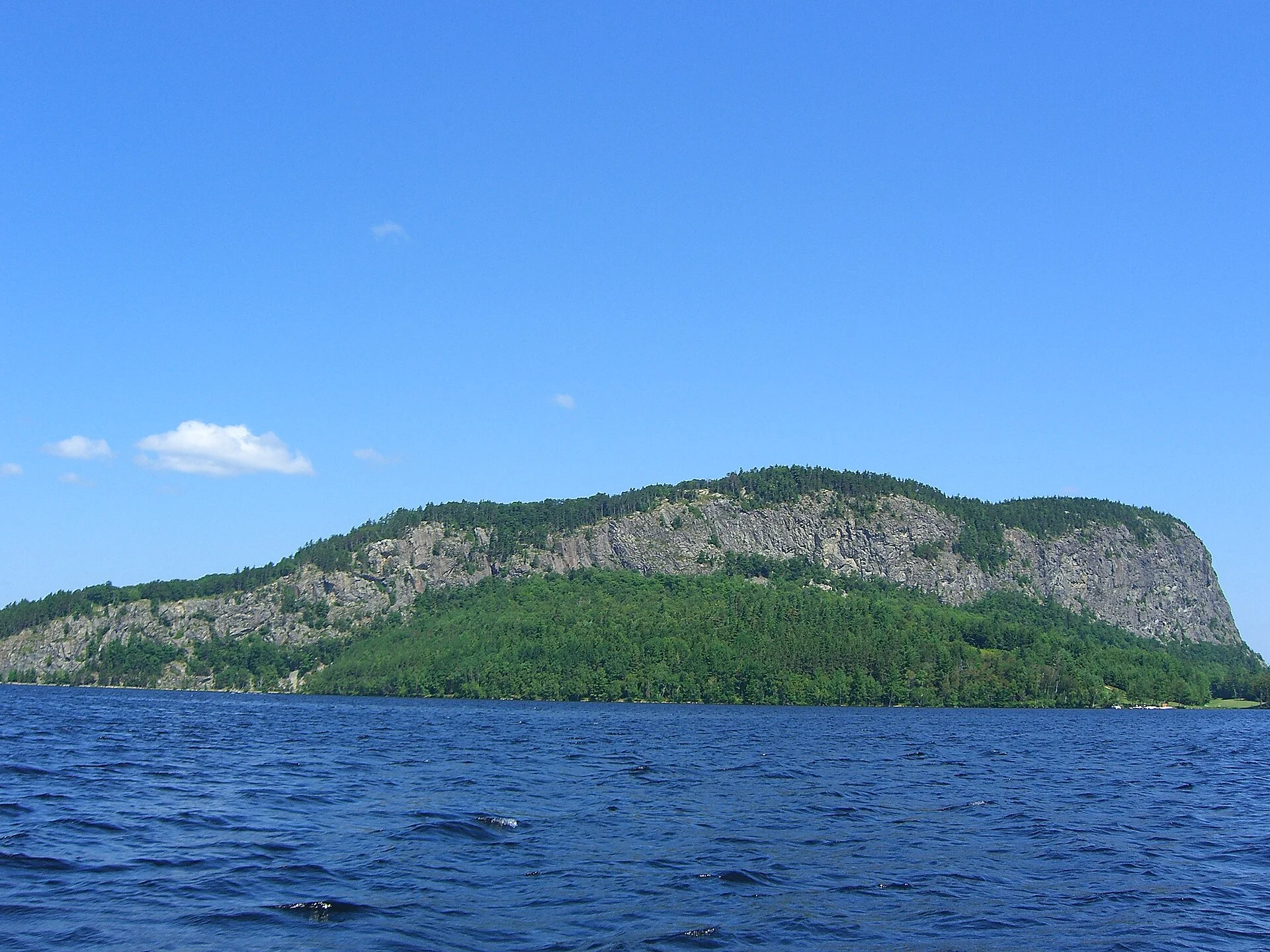
The signature hike of the region. Kineo is a flint peninsula of 700-foot cliffs in the middle of the lake, reached only by water, and its old fire tower has been rebuilt as an observation deck with a 360-degree view of Moosehead, the Spencers and Katahdin. The Indian Trail is the steep, ledgy route with the best views on the way up; the Bridle Trail is the gentler original warden's path; the two link into a 2.6-mile loop that most people do in about two hours from the dock. The Carriage Trail hugs the shore to Hardscrabble Point on old carriage road and is nearly flat, so it suits mixed groups, and the North Trail adds a longer loop past the peregrine falcon cliffs (nesting here since 1987, so keep to the trail in spring).
Getting there: drive Route 6/15 to Rockwood (about 20 miles) and park at the public landing on Village Road. The Kineo shuttle runs late May to mid-October, roughly every two hours in spring and fall and hourly in July and August; it is cash only, $15 round trip, under-fives free, and the last boat back leaves late afternoon, so start early. Pay the state-park day fee at the self-service station by the dock. Trails are rocky and often wet, and the tower stairs are open-grate, so this is not the hike for anyone uneasy with heights.
Sources: Maine Trail Finder · Mount Kineo State Park · State park fee schedule (PDF) · Kineo shuttle schedule · Maine by Foot
Lily Bay State Park
- Trails
- 2.4-mile network; 2-mile shoreline walk
- Effort
- easy
- Drive
- 15 minutes north on Lily Bay Road
- Fee
- $6 non-resident adult, $4 Maine resident
- Dogs
- leashed; not on the beach April–September
- Season
- open year-round, 9 a.m. to sunset
The easy day. Lily Bay is a 925-acre state park on the east shore with a sandy beach, two boat launches and a shoreline path that runs from the beach along Dunn Point and around Rowell Cove to the campground, with the lake and the mountains in view most of the way. It is the walk for a rest day, a family with small children, or an evening loon-watch, and the beach is the best swimming close to town. Black flies are thick here from late May to mid-June, so bring a head net or come in July.
Getting there: 9 miles north of Greenville on Lily Bay Road, then State Park Road on the left to 13 Myrle's Way. Full services run from about May 15 to Columbus Day; in the off-season park outside the gate and walk in. In winter the park grooms a 5-mile cross-country ski loop.
Sources: Maine Trail Finder · Lily Bay State Park · Day-use fees · Trail conditions
Gulf Hagas, the Grand Canyon of Maine
- Round trip
- 8 to 8.6 miles (rim loop 5.2 mi plus approach)
- Climb
- about 1,000 ft, cumulative
- Effort
- moderate, with rough and exposed footing
- Time
- 5–7 hours
- Drive
- 60–90 minutes, mostly gravel
- Fee
- $18 non-resident, $13 resident, cash or check at the checkpoint
- Dogs
- allowed
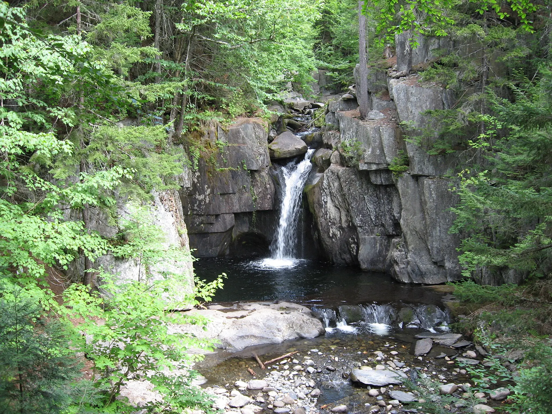
A National Natural Landmark and the best full-day hike within reach: the West Branch of the Pleasant River drops 400 feet in four miles through a slate canyon, and the Rim Trail follows the lip past Screw Auger Falls, Hammond Street Pitch (more than 100 feet deep), the Jaws, Buttermilk Falls, Billings Falls and Stair Falls, returning on the old Pleasant River Tote Road. The Hermitage, a grove of old-growth white pines owned by The Nature Conservancy, stands near the trailhead on the Appalachian Trail. For a shorter outing, Screw Auger Falls alone is about 3.5 miles round trip.
Getting there: from Greenville take Pleasant Street, then East Road and the Katahdin Iron Works Road (gravel) about 11 miles to the Hedgehog Checkpoint of the KI Jo-Mary Forest, then on to the Hay Brook and Head of the Gulf parking, which crosses the river on a bridge. From the Katahdin Iron Works side the West Branch must be forded, about 150 feet of knee-to-thigh-deep water; North Maine Woods says plainly not to attempt the ford in high water. Checkpoints are open about 6 a.m. to 9 p.m. in season, roughly May through October, and take cash or check only. Allow the full day and carry more water than you think you need.
Sources: Maine Trail Finder · North Maine Woods checkpoints and fees · Gulf Hagas map (PDF) · Northeast Hikes guide
Borestone Mountain Audubon Sanctuary
- Round trip
- about 5 miles
- Climb
- about 1,250 ft
- Summits
- West Peak 1,981 ft, East Peak 1,960 ft
- Effort
- moderately strenuous
- Time
- 3–4 hours
- Drive
- about 40 minutes via Monson and Elliotsville Road
- Fee
- $5 suggested donation, cash
- Dogs
- not allowed
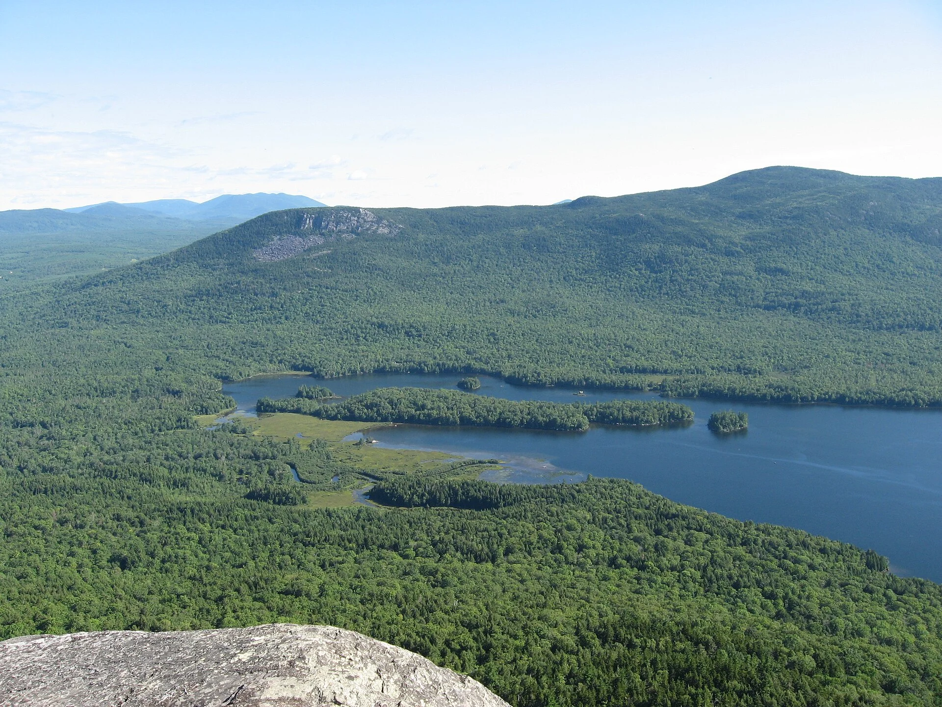
Maine Audubon's mountain, and one of the prettiest walks in the state for its size. The Base Trail climbs a mile through mossy forest to the visitor center on Sunrise Pond, then the Summit Trail takes on the last 0.7 miles with about 130 stone steps and two short ladder scrambles to the bare twin summits, with Lake Onawa, Barren Mountain and the 100-Mile Wilderness spread below. The Peregrine Trail adds a half-mile of cliff overlooks. Because it is a wildlife sanctuary there are no pets, trails are open dawn to dusk, and the visitor center staffs the pond from about Memorial Day into October.
Getting there: from Monson take Route 6/15 north 0.6 miles, turn right on Elliotsville Road for about 7.6 miles, cross the Big Wilson Stream bridge, turn left, and the parking area is about 0.7 miles past the railroad tracks on Bodfish Road. Maine Audubon lists the sanctuary as closed to trail access in winter; call (207) 781-2330 to confirm shoulder-season hours.
Sources: Maine Audubon: Borestone · Borestone trail guide (PDF) · Maine Trail Finder
More summits and waterfalls
- Number Four Mountain (Frenchtown Township) · 4.2 mi round trip · about 1,470 ft · summit 2,893 ft · moderate · 35–40 min. Up Lily Bay Road 13 miles, then Meadow Brook Road and logging roads to a small trailhead (GPS 45.6319, −69.4187). The remains of the fire tower still stand, and the vistas reach Baker Mountain, Lily Bay Mountain and the lake. Strong parties can continue 4.7 miles to Baker Mountain (3,521 ft). Trail page
- Eagle Rock (Big Moose Township) · 7.4 mi round trip from the Little Moose side, about 780 ft · or a steep 1.3 mi round trip with about 1,300 ft of scrambling from VIP Road · summit 2,378 ft. Raven Ledge, a mile before the top, is the best lake view on the long route. East Moore Bog Road is eroded and wants high clearance. Trail page
- White Cap Mountain (Appalachian Trail, 100-Mile Wilderness) · 6.6 mi round trip · about 2,000 ft · summit 3,654 ft · strenuous · allow more than an hour's drive on Frenchtown and Logan Brook roads, high clearance required. A 360-degree summit with Katahdin front and centre, and the last big climb for northbound thru-hikers. Trail page
- Little Wilson Falls (Elliotsville) · 2.4–2.6 mi round trip · about 300 ft · easy · 40 min. A short walk on an Appalachian Trail side trail to a 40-foot waterfall in a 90-foot slate gorge, with viewing platforms and swimming pools below. Low-clearance cars park at the Elliotsville Road turn, which adds about a mile each way. Trail page
- Moxie Falls (Moxie Gore, near The Forks) · 2 mi round trip · about 225 ft · easy · roughly 1 hour 20 minutes. One of New England's highest single drops at about 90 feet, on a gravel path with stairs, boardwalks and platforms; busy on summer weekends and worth pairing with a rafting day. Trail page
Sources: Maine by Foot: Number Four · Maine by Foot: Eagle Rock · Maine by Foot: Little Wilson Falls
The Moosehead Pinnacle Pursuit
Destination Moosehead Lake runs a six-summit challenge for the region: Big Moose, Mount Kineo, Borestone, Eagle Rock, Number Four and White Cap. Download the log from the Pinnacle Pursuit website or pick one up at the Moosehead Lake Visitor Center at 480 Moosehead Lake Road, record the date and time of each summit, and submit it when you finish for a confirmation letter, a patch and a sticker, and a place on the finishers' list. There is no time limit for the standard badge. The Ultra is all six in a continuous 48 hours starting and ending at the gazebo by the Moosehead Marine Museum, a short walk from King's Landing; there is also a winter version and a Trail Crew badge for four days of volunteer trail work with the Moosehead Trails Group. Four of the six are on this page, so a long weekend here makes a real dent in it.
Sources: Moosehead Pinnacle Pursuit · The Maine Highlands
Before you go: safety and preparedness
- Emergencies: call 911. The Maine Warden Service dispatch is 1-800-452-4664, and there is no cell service on Big Moose, White Cap or most of the Gulf, and only patchy coverage on Kineo. Tell someone at the house your route and turnaround time; a satellite messenger is cheap insurance on the longer hikes.
- Bugs and ticks: black flies run late April through June and peak from late May to mid-June: head nets, long sleeves and repellent. Deer ticks carry Lyme, so treat clothing with permethrin, stay mid-trail, and check everyone (and the dog) at the end of the day. Browntail moth hairs can irritate skin in May and June.
- Weather: the summits are 1,000 to 2,000 feet above the lake and snow is possible in any month up high. Carry layers, a shell, a headlamp and more water than the distance suggests. Turn around early on ledges when rain is coming.
- Wildlife: black bears are active April through November; keep food packed away and make noise in thick growth. Give moose a wide berth, especially cows with calves in early summer and bulls in the fall rut; see our moose spotting guide. In hunting season (October and November) wear blaze orange.
- Roads: most of these trailheads are on gravel logging roads. Trucks have the right of way, dust hides oncoming traffic, and you should never block a gate. Expect mud-season closures in April and May and unplowed trailheads in winter; Lily Bay and the Little Moose network are the reliable snowshoe options.
- Leave No Trace: carry out everything, keep to the trail on the alpine ledges, and get a Maine Forest Service permit before any campfire outside a designated site.
Sources: Bureau of Parks and Lands safety page · Maine Warden Service · Maine CDC tick prevention
The Appalachian Trail, the 100-Mile Wilderness and maps
Monson, 20 minutes south, is the last town before the Appalachian Trail's 100-Mile Wilderness, and the Appalachian Trail Conservancy's visitor center at 6 Tenney Hill (open roughly late May to mid-October) sells maps and guidebooks, hands out day-hike sheets and posts current trail alerts. The A.T. crosses Route 6/15 about 3.6 miles north of Monson, and the day hikes above at Little Wilson Falls, Gulf Hagas and White Cap all touch it. The Conservancy's free Hiking Guide to the Moosehead Lake Region (PDF) is a good companion to this page.
For paper, the waterproof Moosehead Lake Adventure Map and the DeLorme Maine Atlas cover every road here; Northwoods Outfitters and Indian Hill Trading Post in Greenville stock gear, and Maine Trail Finder has free maps and GPX tracks for every trail on this page. The house has a stack of local maps and guides in the Mainly Maine library, too.
Sources: Monson A.T. Visitor Center · Maine Trail Finder
Trail maps
Local resources
- Little Moose trailhead (Rt 6/15)Rockwood Rd (Rt 6/15) at the Moose Mountain Inn, GreenvilleStart of the Little Moose network; about 2.4 miles to the pond loop. No fee.
- Big Moose Mountain trailheadNorth Rd, Big Moose Township (2 mi off Rt 6/15)Gravel lot on the right; 4.2 miles round trip to the summit ledges.
- Lily Bay State Park13 Myrle's Way, Greenville(207) 695-2700Shoreline trails, beach and boat launches; day-use fee at the gate.
- Rockwood landing (Kineo shuttle)Village Rd, Rockwood(207) 534-9012Public landing and cash-only shuttle to Mount Kineo, late May to mid-October.
- Borestone Mountain Audubon SanctuaryBodfish Rd, Elliotsville Township(207) 781-2330Trailhead lot for the Base and Summit trails; $5 suggested donation, no dogs.
- Hedgehog Checkpoint (Gulf Hagas)Katahdin Iron Works Rd, Bowdoin College Grant(207) 435-6213KI Jo-Mary Forest gate closest to Greenville for the Head of the Gulf and Hay Brook parking; cash or check.
- Number Four Mountain trailheadMeadow Brook Rd, Frenchtown TownshipLogging-road trailhead 13 miles up Lily Bay Road; fire-tower remains on top.
- Eagle RockEast Moore Bog Rd, Big Moose TownshipLedge summit at 2,378 ft; the long route starts from Little Moose, the short one from VIP Road.
- White Cap Mountain trailheadLogan Brook Rd, Bowdoin College Grant EastAppalachian Trail approach to a 3,654-ft summit; high-clearance vehicle needed.
- Little Wilson FallsElliotsville Rd, Elliotsville TownshipEasy walk to a 40-foot falls in a slate gorge on an A.T. side trail.
- Moxie FallsMoxie Pond Rd, Moxie GoreGravel path, stairs and platforms to a 90-foot waterfall near The Forks.
- Northwoods Outfitters5 Lily Bay Rd, Greenville(207) 695-3288Guided hikes with Registered Maine Guides (Kineo, waterfalls, the B-52 site), gear and maps.
- Destination Moosehead Lake Visitor Center480 Moosehead Lake Rd, Greenville(207) 695-2702Trail advice, Kineo shuttle schedule and Pinnacle Pursuit logs.
- Monson A.T. Visitor Center6 Tenney Hill, Monson(413) 200-0313Appalachian Trail Conservancy center: maps, guidebooks, day-hike sheets and 100-Mile Wilderness alerts, late May to mid-October.
- Indian Hill Trading Post148 Moosehead Lake Rd, Greenville(207) 695-2104Outdoor gear, footwear and supplies, open daily.
On the map
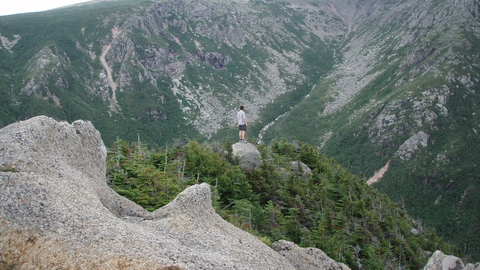
Last reviewed September 2026. Spot something out of date? Tell us. Header photo: A hiker above the ravine on Mount Katahdin, Baxter State Park: nmeyerhans, CC BY-SA 2.0, via Flickr.